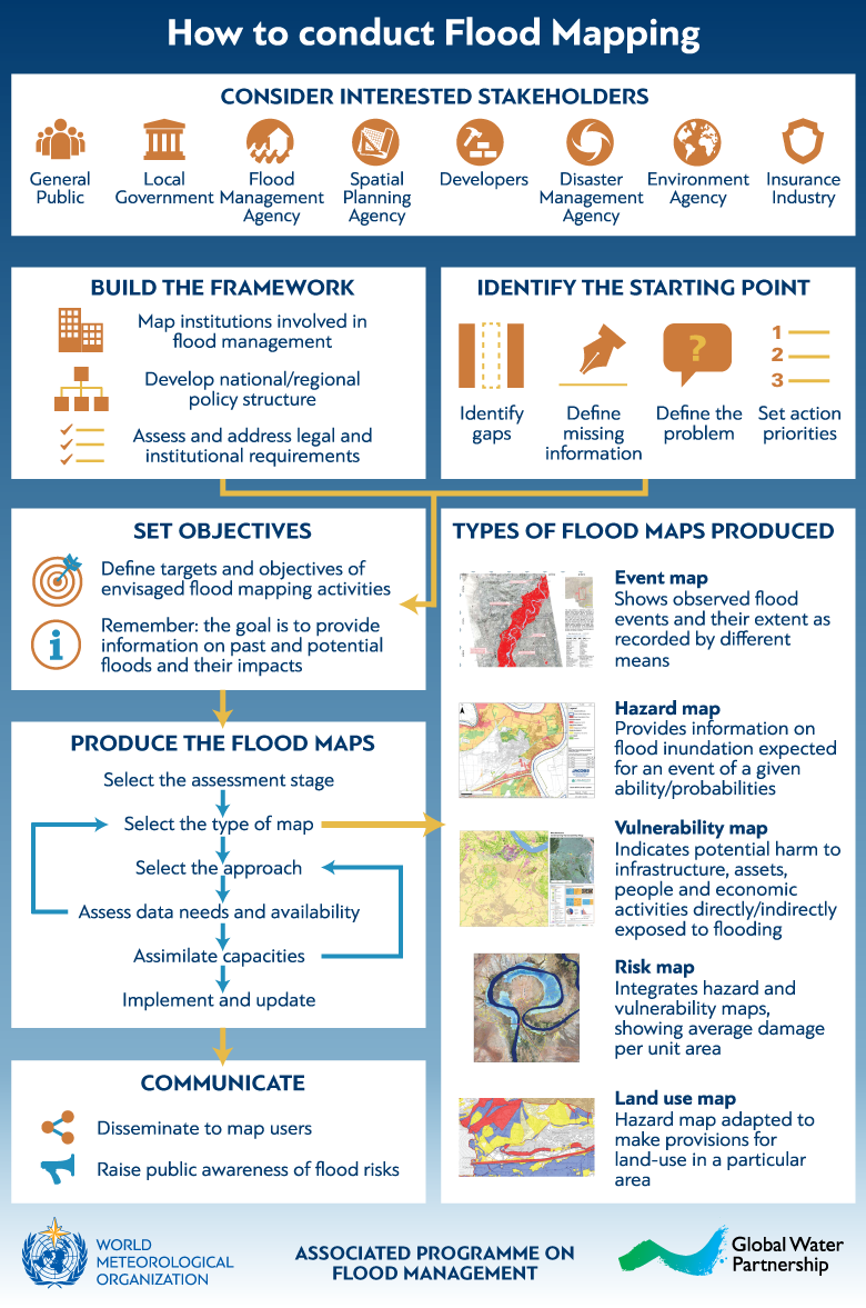
Flood Maps are tools used for visualizing flood information for decision makers and the general public. These maps form the basis for developing flood risk scenarios based on land use, various environmental and climate conditions and including social and economic conditions. Flood maps in their various formats and scales are the basis for the planning and implementation of development alternatives. This interactive infographic illustrates the steps involved in flood mapping, as well as interested stakeholders and types of flood maps.
For detailed technical guidance on this topic, download Flood Mapping from the Flood Management Tools Series.
You may also download PDF versions of this infographic in English and in Spanish.